Applications of the maps
One of the main applications of these maps will be to foster the elaboration of specific questions about mechanisms leading to rainfall feedback and the research to investigate these questions. Some of the specific questions that we have identified include the following:
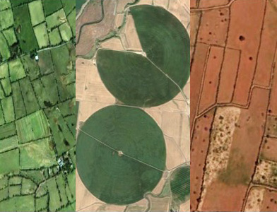
What are the features of landscape, land use and general climate that characterize sites with marked positive rainfall feedback?
Can these features be used to to predict where else positive rainfall feedback might be occurring? In other words, if we identify geographic
sites outside of the regions on our maps with these same features, will they also have marked positive feedback?
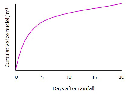
Positive rainfall feedback seems to be associated with a cumulative increase in atmospheric ice nuclei concentrations that persist for about 20 days (1). Is this a consistent trait of sites with positive rainfall feedback? What is the nature of the accumulating ice nucleators; what proportion of them are biological? Does the diversity of ice nucleators that accumulate over several weeks after a rainfall resemble what has been described immediately after a rainfall (2)? Does land cover influence the nature of these ice nucleators?

At sites with no or negative rainfall feedback, is there an absence of ice nuclei accumulation in the atmosphere after a rainfall?
If not, what interferes with their involvement in enhancing rainfall?
(1) Bigg E.K., Soubeyrand S., Morris C.E. 2015. Persistent after-effects of heavy rain on concentrations of ice nuclei and rainfall suggest a biological cause. Atmos. Chem. Phys. 15: 2313-2326.
(2) Huffman, J. A., et al. 2013. High concentrations of biological aerosol particles and ice nuclei during and after rain. Atmos. Chem. and Phys. 13:6151-6164.